| Northwest Corner of Utah |
After spending time in Goblin Valley looking at all the odd and unique shapes, we continue our jeep trail journey. Before coming on this trip, we had to go to one of the offices of the State of Utah to get area maps which show camping sites, picturesque areas, trails, cow paths and all the things a regular map does not show. Our map, which I've misplaced, was in the southeast corner of Utah. A very thin solid line on the map is a fairly good road whereas the dotted lines are jeep trails or cow paths. We headed southwest on a dotted line trail.
| Colorful Maps of Utah |
It was slow going because it truly was a cow path made into a jeep trail. There were huge boulders within the trail that would blow off oil pans or make serious damage underneath a car. Thank goodness that jeeps set higher and have no trouble going over them plus we had a four wheel drive vehicle just in case we needed it. It was nice to have the type that I could put into 4-wheel without jumping out of the jeep and turning the hubs on the front wheels. I just put it in the 4-wheel mode gear.
We had been traveling for about 30 minutes when we came to a stream. There was no bridge. I could see tracks on the other side showing that someone had driven through before. Could I drive through without getting stuck? Was the water too deep? All these thoughts came exploding out of my mouth. My mother was with us and she didn't know. I did not want to go back to Goblin Valley.
I got out and examined the water as closely as I could. It did not seem deep. I got back in my red jeep and was trying to get my nerve up to just drive through going fairly fast so I wouldn't get stuck when to my utter amazement, a car came rambling up on the other side of the creek. They never even paused and drove right through the stream. Well, if they can do it, I can! So I did. Whew!
 |
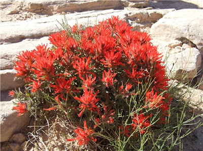
| Indian Paint Brush - Native to Utah |

No comments:
Post a Comment